Richmond weatherWhat’s on in Richmond →
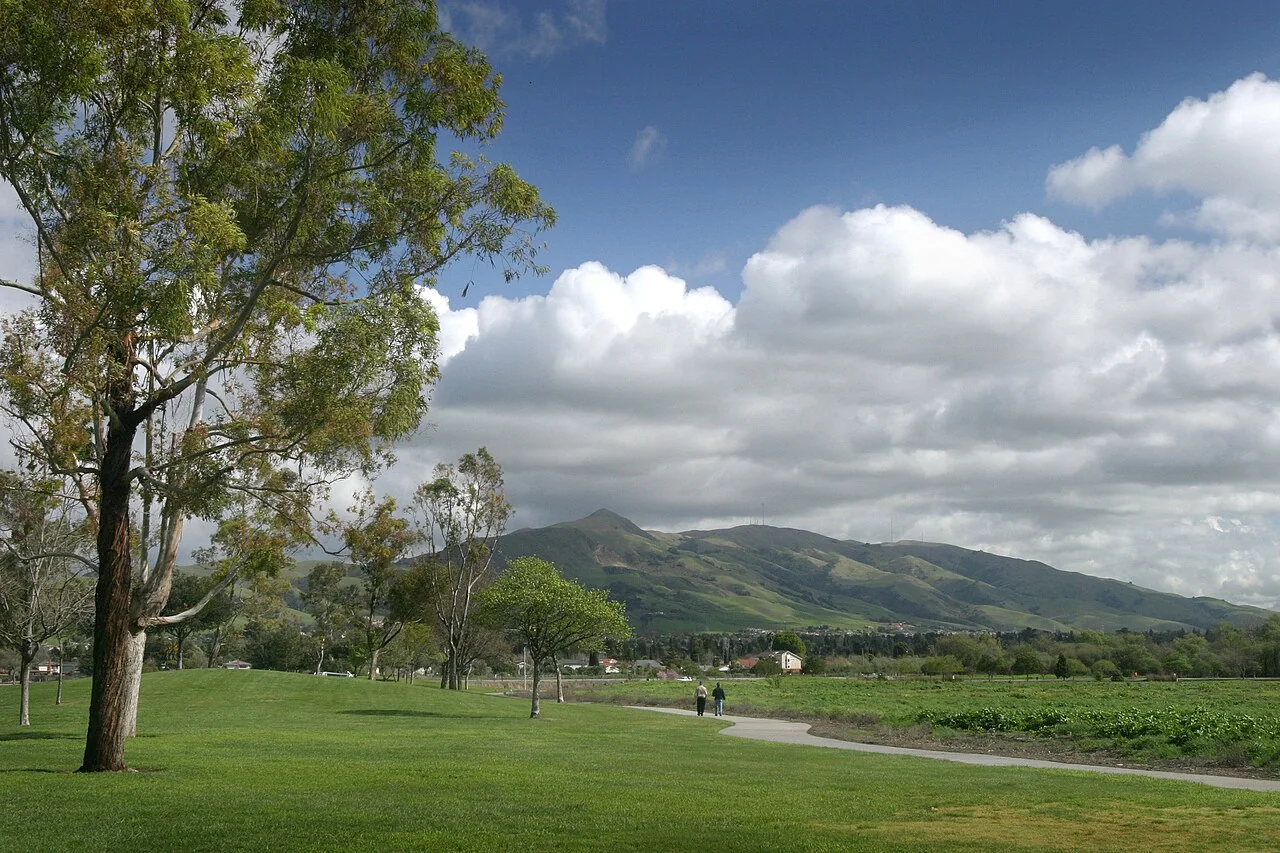
Fremont

Get out of town

Day trips from Richmond

17 nearby parks, towns and places to explore, ordered by straight-line distance.

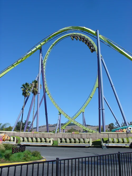
Six Flags Discovery KingdomThings to do

Six Flags Discovery Kingdom

15 miles northeast · straight-line distanceAbout 25 min by car (21 road miles, typical traffic, checked October 2026)

Amusement park in California.

Confirm the visitor entrance, hours, reservations, access and seasonal conditions. Islands or water destinations may require different transport.
Candlestick Point State Recreation AreaState park

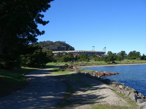
Candlestick Point State Recreation Area

16 miles south · straight-line distance

State park in San Francisco, California, United States.

Confirm the visitor entrance, hours, reservations, access and seasonal conditions. Islands or water destinations may require different transport.
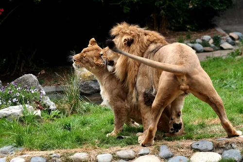
San Francisco ZooThings to do

San Francisco Zoo

16 miles southwest · straight-line distanceAbout 35 min by car (28 road miles, typical traffic, checked October 2026)

Zoo in San Francisco.

Confirm the visitor entrance, hours, reservations, access and seasonal conditions. Islands or water destinations may require different transport.
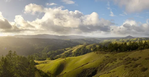
Samuel P. Taylor State ParkState park

Samuel P. Taylor State Park

21 miles west · straight-line distance

State park in Marin County, California, United States.

Confirm the visitor entrance, hours, reservations, access and seasonal conditions. Islands or water destinations may require different transport.
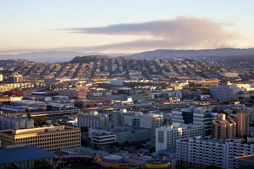
San BrunoTown

San Bruno

22 miles south · straight-line distanceAbout 35 min by car (28 road miles, typical traffic, checked October 2026)

City in San Mateo County, California, United States.

Confirm the visitor entrance, hours, reservations, access and seasonal conditions. Islands or water destinations may require different transport.
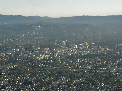
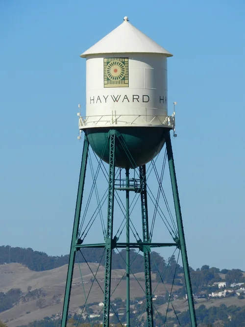
HaywardTown

Hayward

24 miles southeast · straight-line distanceAbout 30 min by car (27 road miles, typical traffic, checked October 2026)

City in Alameda County, California, United States.

Confirm the visitor entrance, hours, reservations, access and seasonal conditions. Islands or water destinations may require different transport.
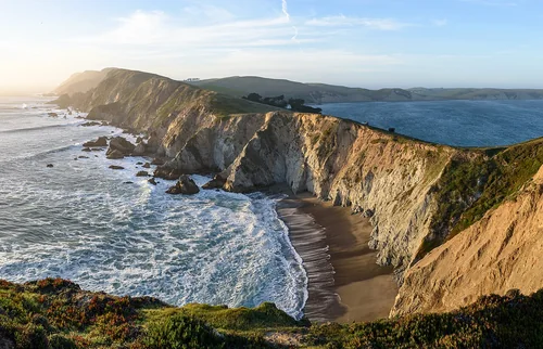
San MateoTown

San Mateo

26 miles south · straight-line distanceAbout 40 min by car (37 road miles, typical traffic, checked October 2026)

City in San Mateo County, California, United States.

Confirm the visitor entrance, hours, reservations, access and seasonal conditions. Islands or water destinations may require different transport.
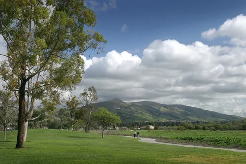
State park

Jack London State Historic Park

31 miles north · straight-line distance

State park in Glen Ellen, California.

Confirm the visitor entrance, hours, reservations, access and seasonal conditions. Islands or water destinations may require different transport.
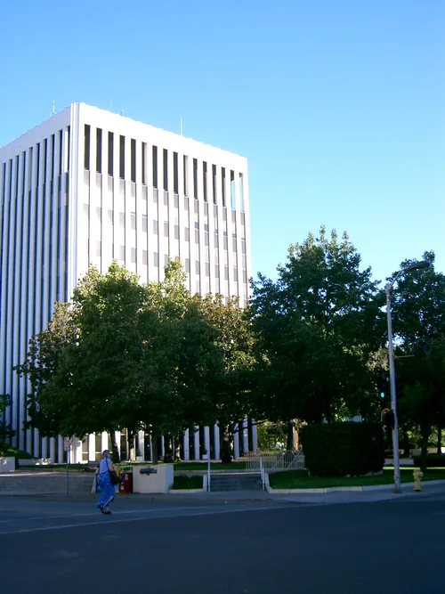
Point Reyes National SeashoreNational park site

Point Reyes National Seashore

31 miles west · straight-line distance

Protected national seashore in northern California, USA.

BikingCampingFishingHikingPaddlingPicnickingAgency site ↗

Confirm the visitor entrance, hours, reservations, access and seasonal conditions. Islands or water destinations may require different transport.
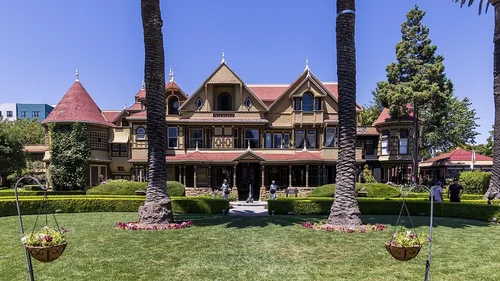
FremontTown

Fremont

33 miles southeast · straight-line distanceAbout 45 min by car (39 road miles, typical traffic, checked October 2026)

City in Alameda County, California, United States.

Confirm the visitor entrance, hours, reservations, access and seasonal conditions. Islands or water destinations may require different transport.
Palo AltoTown

Palo Alto

35 miles south · straight-line distanceAbout 55 min by car (48 road miles, typical traffic, checked October 2026)

City in Santa Clara County, California, United States.

Confirm the visitor entrance, hours, reservations, access and seasonal conditions. Islands or water destinations may require different transport.
Outdoors

Bethel Island

39 miles east · straight-line distance

Island in the United States of America.

Confirm the visitor entrance, hours, reservations, access and seasonal conditions. Islands or water destinations may require different transport.
Lake

Lake Berryessa

44 miles north · straight-line distance

Reservoir in Napa County, California, United States.

Confirm the visitor entrance, hours, reservations, access and seasonal conditions. Islands or water destinations may require different transport.

Winchester Mystery HouseThings to do

Winchester Mystery House

48 miles southeast · straight-line distanceAbout 1 hr by car (55 road miles, typical traffic, checked October 2026)

Mansion in San Jose, California.

Confirm the visitor entrance, hours, reservations, access and seasonal conditions. Islands or water destinations may require different transport.

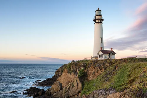
Pigeon Point LighthouseOutdoors

Pigeon Point Lighthouse

52 miles south · straight-line distanceAbout 1 hr 15 min by car (66 road miles, typical traffic, checked October 2026)

Lighthouse in California, United States.

Confirm the visitor entrance, hours, reservations, access and seasonal conditions. Islands or water destinations may require different transport.

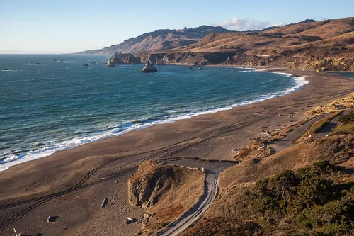
Goat Rock BeachOutdoors

Goat Rock Beach

55 miles northwest · straight-line distanceAbout 1 hr 25 min by car (71 road miles, typical traffic, checked October 2026)

Beach in Sonoma County, California.

Confirm the visitor entrance, hours, reservations, access and seasonal conditions. Islands or water destinations may require different transport.

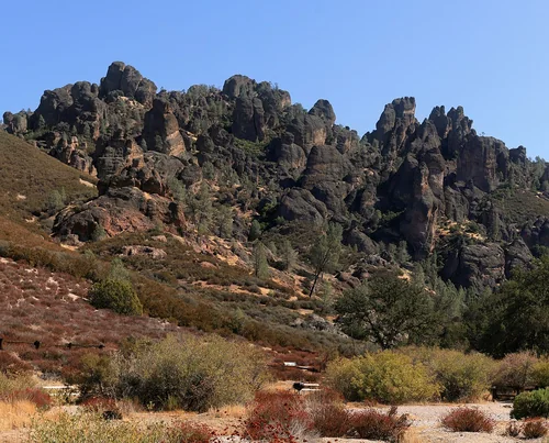
Pinnacles National ParkNational park site

Pinnacles National Park

119 miles southeast · straight-line distance

National park in California, United States of America.

Confirm the visitor entrance, hours, reservations, access and seasonal conditions. Islands or water destinations may require different transport.

Driving times are typical estimates from the city center without live traffic, Powered by Geoapify · © OpenStreetMap contributors.

Distances are straight-line measurements from the city, not driving distance. Saved road estimates have no consistently recorded source date and are not current traffic; estimates to park centers, water locations or inconsistent routes are omitted. Named-destination route links are not verified entrances. Place descriptions come from Wikidata; photo credits below include recorded capture dates when available. A photograph does not show current conditions.

Outdoor places near Richmond

40 recreation areas and campgrounds within 94 miles, from Recreation.gov. Filter by what you want to do.

Recreation area

Rosie the Riveter WWII Home Front National Historical Park

2 miles south · straight-line distanceNational Park Service

Celebrate and honor the contributions and sacrifices of American civilians on the WWII home front. Discover how diverse communities lived, worked, and interacted.

History

Recreation area

Marin Islands National Wildlife Refuge

7 miles west · straight-line distanceFish and Wildlife Service

More info to come.

Fishing

Campground

Aquatic Park Cove, Black Point Overnight Anchoring, Sailing Vessels only (auxiliary engine OK)

10 miles southwest · straight-line distanceAbout 30 min by car (19 road miles, checked October 2026)National Park Service

Aquatic Park Cove is a vibrantly urban harbor that mimics a natural anchorage and is located on the Pacific shores of one of America's great West Coast cities.

BikingBoatingCampingClimbingFishingHikingHistoryHorseback riding

Campground

Kirby Cove Campground

10 miles southwest · straight-line distanceAbout 25 min by car (20 road miles, checked October 2026)National Park Service

Kirby Cove is located just north of the Golden Gate Bridge at historic Battery Kirby. Visitors are awarded breathtaking views of San Francisco, its famous Golden Gate Bridge, and the rugged Pacific Coast of northern California.

BirdingCampingFishingHikingHistoryMountain BikingPicnickingWater Access

Recreation area

S F Bay Model Regional Visitor Center

10 miles southwest · straight-line distanceUS Army Corps of Engineers

The Bay Model was built in 1957 as a research tool to test the impact of proposed changes to San Francisco Bay and its related waterways.

BoatingFishingHistoryPicnickingWater sportsWildlife viewing

Recreation area

San Francisco Maritime National Historical Park

10 miles southwest · straight-line distanceNational Park Service

Established in 1988, San Francisco Maritime National Historical Park celebrates America’s maritime heritage on the Pacific Coast. Our 50-acre park has grown around Aquatic Park Cove, a protected area in the stunning San Francisco Bay.

BoatingHistory

Recreation area

Fort Point National Historic Site

11 miles southwest · straight-line distanceNational Park Service

From its vantage point overlooking the spectacular Golden Gate, Fort Point defended the San Francisco Bay following California's Gold Rush through World War II.

History

Recreation area

Greater Farallones National Marine Sanctuary

11 miles southwest · straight-line distanceNational Oceanic and Atmospheric Administration

An area of 3,295 square miles off the northern and central California coast, Greater Farallones National Marine Sanctuary protects the wildlife and habitats of one of the most diverse and bountiful marine environments in the world.

BoatingDivingFishingPaddlingPhotographyRanger programsSnorkelingSwimming

Campground

Bicentennial Campground

12 miles southwest · straight-line distanceAbout 30 min by car (22 road miles, checked October 2026)National Park Service

Bicentennial Campground is in an ideal location in the Marin Headlands surrounded by a grove of cypress trees. The campground is a great location for those wanting to camp near the city.

BikingCampingHistoryMountain Biking

Campground

Haypress Campground

12 miles southwest · straight-line distanceNational Park Service

Haypress Campground is nestled within the coastal scrub of Tennessee Valley, near Mill Valley. The hike to this campground is 1 mile from the Tennessee Valley Trail head parking lot, which means car or RV camping is not allowed.

BikingBirdingCampingHikingWildlife viewing

Recreation area

John Muir National Historic Site

12 miles east · straight-line distanceNational Park Service

John Muir’s life was a tapestry of roles—fruit rancher, family man, writer—each interwoven with his deep love for nature.

HikingWildlife viewing

Campground

Rob Hill Group Campground

12 miles southwest · straight-line distanceAbout 30 min by car (22 road miles, checked October 2026)Presidio Trust

As San Francisco's only group campground, Rob Hill offers a national park camping experience just minutes from the city.

BikingBirdingCampingHikingHistory

Recreation area

Muir Woods National Monument

13 miles west · straight-line distanceNational Park Service

Walk among old growth coast redwoods, cooling their roots in the fresh water of Redwood Creek and lifting their crowns to reach the sun and fog.

HikingWildlife viewing

Recreation area

Golden Gate National Recreation Area

15 miles west · straight-line distanceNational Park Service

Experience a park so rich it supports 19 distinct ecosystems with over 2,000 plant and animal species.

BikingCampingFishingHikingHistoryHorseback ridingPicnickingWildlife viewing

Recreation area

San Pablo Bay National Wildlife Refuge

15 miles northwest · straight-line distanceFish and Wildlife Service

In response to rapidly disappearing wetlands and its prime location within the Pacific Flyway, the refuge was created in 1974 to protect migratory birds, wetland habitat, and endangered species.

BoatingFishingHuntingPhotographyRanger programs

Recreation area

Eugene O'Neill National Historic Site

19 miles southeast · straight-line distanceNational Park Service

America's only Nobel Prize-winning playwright, Eugene O'Neill, chose Northern California as his sanctuary at the pinnacle of his writing career.

History

Recreation area

Cordell Bank National Marine Sanctuary

25 miles west · straight-line distanceNational Oceanic and Atmospheric Administration

Entirely offshore, Cordell Bank National Marine Sanctuary protects soft seafloor habitat, a rocky bank, deep-sea canyons, and diverse wildlife, while acting as a feeding ground for many marine mammals and seabirds.

BoatingFishingWildlife viewing

Campground

Point Reyes National Seashore Campground

26 miles west · straight-line distanceAbout 50 min by car (32 road miles, checked October 2026)National Park Service

Point Reyes National Seashore offers four backcountry hike in campgrounds and thirteen boat in campsites along Tomales Bay. Note: For reservation purposes, our campgrounds are organized under the "loop" column of the reservation grid.

BackpackingBikingBirdingBoatingCampingHikingHistoryHorse Camping

Recreation area

San Francisco Bay National Estuarine Research Reserve

26 miles northeast · straight-line distanceNational Oceanic and Atmospheric Administration

The San Francisco Bay National Estuarine Research Reserve comprises two components located along the salinity gradient of the San Francisco Bay.

PaddlingPhotography

Recreation area

Contra Loma Reservoir

29 miles east · straight-line distanceBureau of Reclamation

Contra Loma Dam and reservoir are part of the Central Valley Project - Delta Division and offers recreational opportunities for the East Bay area near San Francisco.

BikingBoatingFishingHikingHorseback ridingPicnickingRecreational VehiclesWater sports

Recreation area

Point Reyes National Seashore

30 miles west · straight-line distanceNational Park Service

From its thunderous ocean breakers crashing against rocky headlands and expansive sand beaches to its open grasslands, brushy hillsides, and forested ridges, Point Reyes offers visitors over 1500 species of plants and animals to discover.

BikingCampingFishingHikingPaddlingPicnickingWildlife viewing

Recreation area

Antioch Dunes National Wildlife Refuge

31 miles east · straight-line distanceFish and Wildlife Service

Antioch Dunes National Wildlife Refuge is the only national wildlife refuge in the country established to protect endangered plants and insects – the Antioch Dunes evening primrose, the Contra Costa wallflower, and the Lange’s metalmark…

Ranger programs

Recreation area

Don Edwards San Francisco Bay National Wildlife Refuge

32 miles southeast · straight-line distanceFish and Wildlife Service

Don Edwards San Francisco Bay National Wildlife Refuge is located in a vast cultural and natural landscape.

BikingBirdingBoatingFishingHuntingNature educationPhotographyRanger programs

Recreation area

Lake Berryessa

42 miles north · straight-line distanceBureau of Reclamation

Nestled between Blue Ridge and Cedar Roughs, east of the Napa Valley, Lake Berryessa offers year-round recreation opportunities.

BikingBoatingCampingFishingHikingHistoryHorseback ridingHotel/Lodge/Resort Fs Owned

Recreation area

Lake Solano

42 miles northeast · straight-line distanceBureau of Reclamation

Lake Solano Park, Solano Project , is located at the base of coastal foothills at the western edge of the Sacramento Valley and offers an array of recreational opportunities.

BikingBoatingCampingFishingHikingNature educationPicnickingRanger programs

Recreation area

Cedar Roughs Wilderness

44 miles north · straight-line distanceBureau of Land Management

The Cedar Roughs Wilderness now contains a total of 6,287 acres and is managed by the Bureau of Land Management. All of the Wilderness is in the state of California.

CampingHikingHuntingWildernessWildlife viewing

Campground

Oak Shores Day Use Area (Ca)

44 miles north · straight-line distanceAbout 1 hr 20 min by car (59 road miles, checked October 2026)Bureau of Reclamation

Nestled between Blue Ridge and Cedar Roughs east of Napa Valley, Lake Berryessa provides ample public recreation opportunities.

BirdingCampingCanoeingFishingGuided Interpretive WalksHikingKayakingNature education

Recreation area

Cosumnes River

54 miles northeast · straight-line distanceBureau of Land Management

Remember your OUTDOOR ETHICS when enjoying your public lands. Please RECREATE RESPONSIBLY. Explore, learn, and experience the Cosumnes River Preserve with opportunities for guided walks, paddling, hiking, and nature viewing.

Accessible Facility Or ActivityBird WatchingCanoeingGuided Interpretive WalksPhotographyWildlife viewing

Recreation area

Stone Lakes National Wildlife Refuge

55 miles northeast · straight-line distanceFish and Wildlife Service

With acquisition of the first property in 1994, Stone Lakes National Wildlife Refuge was officially established as the 505th unit in the National Wildlife Refuge System.

BirdingEducational ProgramsFishingHikingHuntingRanger programs

Recreation area

Knoxville Management Area

62 miles north · straight-line distanceBureau of Land Management

Due to its close proximity to the Sacramento and San Francisco Bay Area regions, and because of its varied terrain, Knoxville's 17,700 acres attract many off-highway vehicle (OHV) enthusiasts each year.

BikingCampingFishingHikingHuntingOff-highway vehiclesPhotographyWildlife viewing

Recreation area

Knoxville Recreation Area

62 miles north · straight-line distanceBureau of Land Management

Due to its close proximity to the Sacramento and San Francisco Bay Area regions, and because of its varied terrain, Knoxville's 17,700 acres attract many off-highway vehicle (OHV) enthusiasts each year.

CampingHuntingOff-highway vehicles

Campground

Boat-In Sites (Lake Sonoma)

64 miles northwest · straight-line distanceAbout 1 hr 20 min by car (78 road miles, checked October 2026)US Army Corps of Engineers

Lake Sonoma's Boat-In Sites are scattered around beautiful Lake Sonoma, only a 45-minute drive north of Santa Rosa and a two-hour drive from San Francisco.

BoatingCampingFishingHikingSwimmingWater sports

Campground

Warm Springs Rec Area

65 miles northwest · straight-line distanceAbout 1 hr 20 min by car (77 road miles, checked October 2026)US Army Corps of Engineers

Warm Springs Recreation Area is a day-use park located at Lake Sonoma, which is just a 45 minute drive north of Santa Rosa and a 2 hour trip from San Francisco.

CampingDisc GolfPicnicking

Campground

Liberty Glen (Lake Sonoma)

66 miles northwest · straight-line distanceAbout 1 hr 30 min by car (82 road miles, checked October 2026)US Army Corps of Engineers

Liberty Glen Campground is located at the top of Rockpile Road overlooking Lake Sonoma. A short 45-minute drive north of Santa Rosa and a two-hour drive from San Francisco.

BikingCampingHiking

Campground

Coyote Point

82 miles east · straight-line distanceAbout 1 hr 50 min by car (110 road miles, checked October 2026)US Army Corps of Engineers

Coyote Point sits along New Hogan Lake in the brush-covered foothills of the Sierra Nevada Mountains.

BoatingCampingFishingHikingMountain BikingSwimmingWater Access

Campground

Deer Flat Boat In Campground

85 miles east · straight-line distanceAbout 2 hr 10 min by car (110 road miles, checked October 2026)US Army Corps of Engineers

New Hogan Dam and Lake is located in the oak- and brush-covered foothills of the Sierra Nevada Mountains. The 4,400 acre lake was created in 1964 with the completion of New Hogan Dam.

BoatingCampingFishingHikingHuntingSwimmingWater AccessWildlife viewing

Campground

Observation Point Picnic Shelter (Ca)

85 miles east · straight-line distanceAbout 2 hr 10 min by car (110 road miles, checked October 2026)US Army Corps of Engineers

New Hogan Dam and Lake is located in the oak- and brush-covered foothills of the Sierra Nevada Mountains. The 4,400 acre lake was created in 1964 with the completion of New Hogan Dam.

BikingCampingFishingSwimming

Campground

Acorn Campground

86 miles east · straight-line distanceAbout 2 hr 10 min by car (109 road miles, checked October 2026)US Army Corps of Engineers

Acorn Campground is a sunny campground in the brush-covered hills of the Sierra Nevada Mountains. The area is generally characterized by a warm, dry climate with summer temperatures regularly soaring above 90 degrees.

BoatingCampingFishingHikingHuntingSwimming

Campground

Oak Knoll Campground

86 miles east · straight-line distanceAbout 2 hr 10 min by car (109 road miles, checked October 2026)US Army Corps of Engineers

Oak Knoll Campground sits along New Hogan Lake in the brush-covered foothills of the Sierra Nevada Mountains. Recreation Boating is a popular pastime, with boat ramps conveniently located around the lake.

BoatingCampingFishingHikingHuntingSwimming

Campground

Little Stony

94 miles north · straight-line distanceAbout 2 hr 40 min by car (138 road miles, checked October 2026)USDA Forest Service

This location is available on a first-come, first-served basis only. Visitors are required to physically arrive at the campground to purchase and claim a site.

CampingFishingOff Highway Vehicle Trails

Recreation areas and campgrounds from Recreation.gov's directory, checked October 9, 2026. Listings are not live availability: check Recreation.gov or the managing agency for open dates, fees, reservations and conditions. Directions go to the listed coordinates, which may not be the entrance. Campground driving times: Powered by Geoapify · © OpenStreetMap contributors.

Questions

What day-trip ideas are near Richmond?

This guide includes Six Flags Discovery Kingdom, Candlestick Point State Recreation Area, San Francisco Zoo, Samuel P. Taylor State Park, San Bruno. Places are ordered by straight-line distance. Confirm visitor access, opening hours and current travel conditions before choosing a trip.

How far is Six Flags Discovery Kingdom from Richmond?

Approximately 15 miles northeast in a straight line; driving takes about 25 min over 21 road miles in typical traffic (Geoapify, checked October 2026). This is not current traffic or a route to a verified visitor entrance. Use the named destination and confirm the appropriate entrance or transport.

How far is Candlestick Point State Recreation Area from Richmond?

Approximately 16 miles south in a straight line. This is not current traffic or a route to a verified visitor entrance. Use the named destination and confirm the appropriate entrance or transport.

How far is San Francisco Zoo from Richmond?

Approximately 16 miles southwest in a straight line; driving takes about 35 min over 28 road miles in typical traffic (Geoapify, checked October 2026). This is not current traffic or a route to a verified visitor entrance. Use the named destination and confirm the appropriate entrance or transport.

Where can I camp near Richmond?

Recreation.gov lists 16 campgrounds within 94 miles, including Aquatic Park Cove, Black Point Overnight Anchoring, Sailing Vessels only (auxiliary engine OK) (10 miles southwest), Kirby Cove Campground (10 miles southwest), Bicentennial Campground (12 miles southwest). Check Recreation.gov for current availability, seasons and reservations.

Richmond AI

Your Richmond local guide
Hey there!

I'm Richmond AI. Ask about neighborhood food, independent shops, local history or planning a visit.

AI recommendations may be inaccurate. Verify hours and prices. Questions are processed by Cloudflare. Privacy