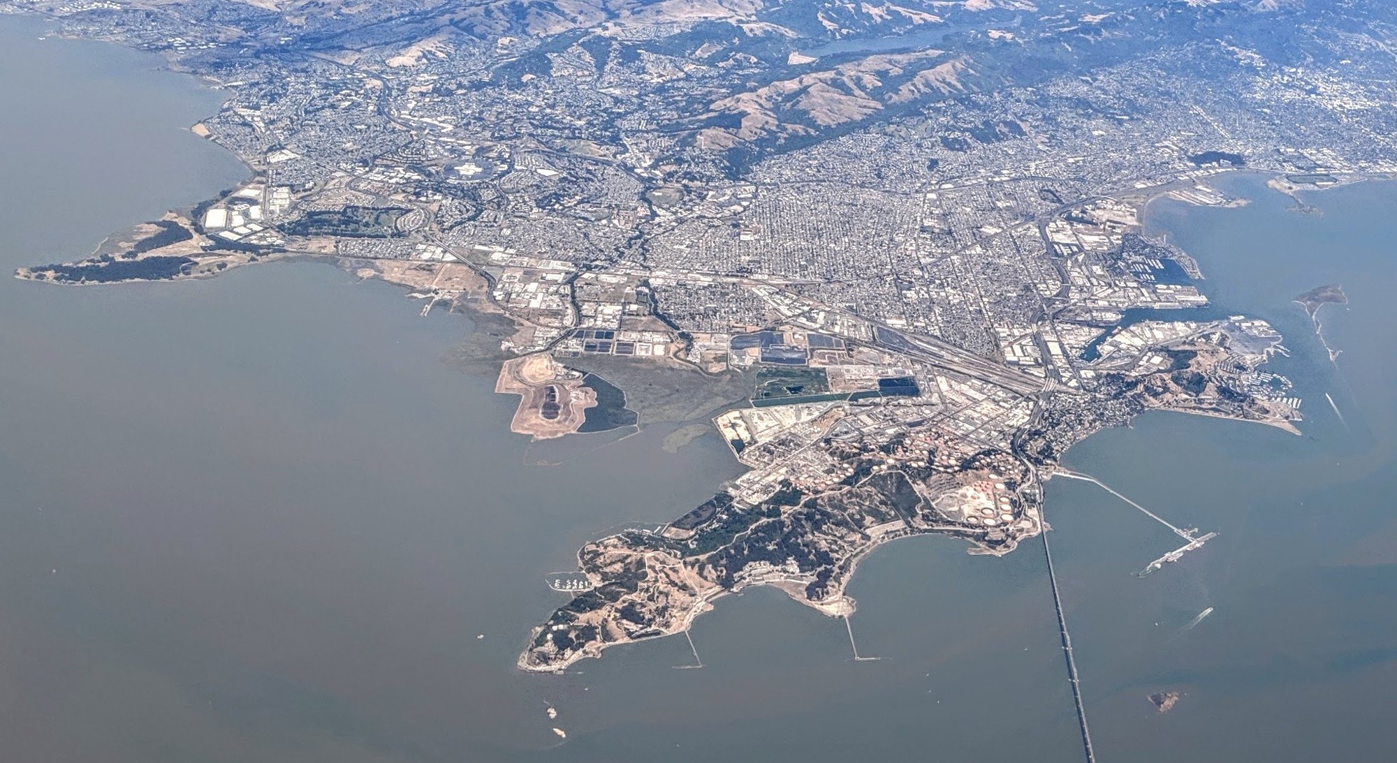
Aerial view of Richmond and the San Rafael Bay

Outdoors

Hiking near Richmond

National forests, parks, lakes and recreation areas with hiking trails near Richmond, closest first.

Good to know: Carry more water than you think you need, check the managing agency’s page for trail closures and fire restrictions, and start early on hot days.

Within 30 miles (10)

10 mi southwest · National Park Service · Campground

Aquatic Park Cove, Black Point Overnight Anchoring, Sailing Vessels only (auxiliary engine OK)

Aquatic Park Cove is a vibrantly urban harbor that mimics a natural anchorage and is located on the Pacific shores of one of America's great West Coast cities.

  • Biking
  • Boating
  • Camping
  • Climbing
  • Fishing
  • Hiking
  • History
  • Horseback riding

10 mi southwest · National Park Service · Campground

Kirby Cove Campground

Kirby Cove is located just north of the Golden Gate Bridge at historic Battery Kirby. Visitors are awarded breathtaking views of San Francisco, its famous Golden Gate Bridge, and the rugged Pacific Coast of northern California.

  • Birding
  • Camping
  • Fishing
  • Hiking
  • History
  • Mountain Biking
  • Picnicking
  • Water Access

12 mi southwest · National Park Service · Campground

Haypress Campground

Haypress Campground is nestled within the coastal scrub of Tennessee Valley, near Mill Valley. The hike to this campground is 1 mile from the Tennessee Valley Trail head parking lot, which means car or RV camping is not allowed.

  • Biking
  • Birding
  • Camping
  • Hiking
  • Wildlife viewing

12 mi east · National Park Service

John Muir National Historic Site

John Muir’s life was a tapestry of roles—fruit rancher, family man, writer—each interwoven with his deep love for nature.

  • Hiking
  • Wildlife viewing

12 mi southwest · Presidio Trust · Campground

Rob Hill Group Campground

As San Francisco's only group campground, Rob Hill offers a national park camping experience just minutes from the city.

  • Biking
  • Birding
  • Camping
  • Hiking
  • History

13 mi west · National Park Service

Muir Woods National Monument

Walk among old growth coast redwoods, cooling their roots in the fresh water of Redwood Creek and lifting their crowns to reach the sun and fog.

  • Hiking
  • Wildlife viewing

15 mi west · National Park Service

Golden Gate National Recreation Area

Experience a park so rich it supports 19 distinct ecosystems with over 2,000 plant and animal species.

  • Biking
  • Camping
  • Fishing
  • Hiking
  • History
  • Horseback riding
  • Picnicking
  • Wildlife viewing

26 mi west · National Park Service · Campground

Point Reyes National Seashore Campground

Point Reyes National Seashore offers four backcountry hike in campgrounds and thirteen boat in campsites along Tomales Bay. Note: For reservation purposes, our campgrounds are organized under the "loop" column of the reservation grid.

  • Backpacking
  • Biking
  • Birding
  • Boating
  • Camping
  • Hiking
  • History
  • Horse Camping

29 mi east · Bureau of Reclamation

Contra Loma Reservoir

Contra Loma Dam and reservoir are part of the Central Valley Project - Delta Division and offers recreational opportunities for the East Bay area near San Francisco.

  • Biking
  • Boating
  • Fishing
  • Hiking
  • Horseback riding
  • Picnicking
  • Recreational Vehicles
  • Water sports

30 mi west · National Park Service

Point Reyes National Seashore

From its thunderous ocean breakers crashing against rocky headlands and expansive sand beaches to its open grasslands, brushy hillsides, and forested ridges, Point Reyes offers visitors over 1500 species of plants and animals to discover.

  • Biking
  • Camping
  • Fishing
  • Hiking
  • Paddling
  • Picnicking
  • Wildlife viewing

30 to 75 miles (8)

42 mi north · Bureau of Reclamation

Lake Berryessa

Nestled between Blue Ridge and Cedar Roughs, east of the Napa Valley, Lake Berryessa offers year-round recreation opportunities.

  • Biking
  • Boating
  • Camping
  • Fishing
  • Hiking
  • History
  • Horseback riding
  • Hotel/Lodge/Resort Fs Owned

42 mi northeast · Bureau of Reclamation

Lake Solano

Lake Solano Park, Solano Project , is located at the base of coastal foothills at the western edge of the Sacramento Valley and offers an array of recreational opportunities.

  • Biking
  • Boating
  • Camping
  • Fishing
  • Hiking
  • Nature education
  • Picnicking
  • Ranger programs

44 mi north · Bureau of Land Management

Cedar Roughs Wilderness

The Cedar Roughs Wilderness now contains a total of 6,287 acres and is managed by the Bureau of Land Management. All of the Wilderness is in the state of California.

  • Camping
  • Hiking
  • Hunting
  • Wilderness
  • Wildlife viewing

44 mi north · Bureau of Reclamation · Campground

Oak Shores Day Use Area (Ca)

Nestled between Blue Ridge and Cedar Roughs east of Napa Valley, Lake Berryessa provides ample public recreation opportunities.

  • Birding
  • Camping
  • Canoeing
  • Fishing
  • Guided Interpretive Walks
  • Hiking
  • Kayaking
  • Nature education

55 mi northeast · Fish and Wildlife Service

Stone Lakes National Wildlife Refuge

With acquisition of the first property in 1994, Stone Lakes National Wildlife Refuge was officially established as the 505th unit in the National Wildlife Refuge System.

  • Birding
  • Educational Programs
  • Fishing
  • Hiking
  • Hunting
  • Ranger programs

62 mi north · Bureau of Land Management

Knoxville Management Area

Due to its close proximity to the Sacramento and San Francisco Bay Area regions, and because of its varied terrain, Knoxville's 17,700 acres attract many off-highway vehicle (OHV) enthusiasts each year.

  • Biking
  • Camping
  • Fishing
  • Hiking
  • Hunting
  • Off-highway vehicles
  • Photography
  • Wildlife viewing

64 mi northwest · US Army Corps of Engineers · Campground

Boat-In Sites (Lake Sonoma)

Lake Sonoma's Boat-In Sites are scattered around beautiful Lake Sonoma, only a 45-minute drive north of Santa Rosa and a two-hour drive from San Francisco.

  • Boating
  • Camping
  • Fishing
  • Hiking
  • Swimming
  • Water sports

66 mi northwest · US Army Corps of Engineers · Campground

Liberty Glen (Lake Sonoma)

Liberty Glen Campground is located at the top of Rockpile Road overlooking Lake Sonoma. A short 45-minute drive north of Santa Rosa and a two-hour drive from San Francisco.

  • Biking
  • Camping
  • Hiking

75 miles and farther (4)

82 mi east · US Army Corps of Engineers · Campground

Coyote Point

Coyote Point sits along New Hogan Lake in the brush-covered foothills of the Sierra Nevada Mountains.

  • Boating
  • Camping
  • Fishing
  • Hiking
  • Mountain Biking
  • Swimming
  • Water Access

85 mi east · US Army Corps of Engineers · Campground

Deer Flat Boat In Campground

New Hogan Dam and Lake is located in the oak- and brush-covered foothills of the Sierra Nevada Mountains. The 4,400 acre lake was created in 1964 with the completion of New Hogan Dam.

  • Boating
  • Camping
  • Fishing
  • Hiking
  • Hunting
  • Swimming
  • Water Access
  • Wildlife viewing

86 mi east · US Army Corps of Engineers · Campground

Acorn Campground

Acorn Campground is a sunny campground in the brush-covered hills of the Sierra Nevada Mountains. The area is generally characterized by a warm, dry climate with summer temperatures regularly soaring above 90 degrees.

  • Boating
  • Camping
  • Fishing
  • Hiking
  • Hunting
  • Swimming

86 mi east · US Army Corps of Engineers · Campground

Oak Knoll Campground

Oak Knoll Campground sits along New Hogan Lake in the brush-covered foothills of the Sierra Nevada Mountains. Recreation Boating is a popular pastime, with boat ramps conveniently located around the lake.

  • Boating
  • Camping
  • Fishing
  • Hiking
  • Hunting
  • Swimming

Distances are straight-line miles from downtown Richmond. Listings come from Recreation.gov’s federal recreation database; check each official page for hours, fees, fire restrictions and closures before you go.

More outdoors near Richmond

Questions

Where is the closest place for hiking near Richmond?

Aquatic Park Cove, Black Point Overnight Anchoring, Sailing Vessels only (auxiliary engine OK) (National Park Service), about 10 miles southwest of Richmond as the crow flies. Next are Kirby Cove Campground (10 mi) and Haypress Campground (12 mi).

When is the best time for hiking near Richmond?

Based on Richmond’s average highs, all year. Conditions at higher elevations can be much cooler.

Who manages these places?

Federal agencies including National Park Service, US Army Corps of Engineers, Bureau of Reclamation. Each listing links to its official page for hours, fees, closures and current conditions.

Richmond AI

Your Richmond local guide
Hey there!

I'm Richmond AI. Ask about neighborhood food, independent shops, local history or planning a visit.

AI recommendations may be inaccurate. Verify hours and prices. Questions are processed by Cloudflare. Privacy